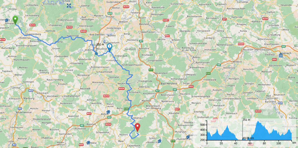
distance_on_map.png

Size of this preview: 800 × 396 pixels. Other resolutions: 130 × 64 pixels 325 × 161 pixels 651 × 323 pixels 976 × 484 pixels 1302 × 646 pixels
app:faq:distance_on_map.png ( 1302 × 646 pixels )
Information
| Date: | 2018/06/14 09:50 |
|---|---|
| Filename: | distance_on_map.png |
| Format: | PNG |
| Size: | 1MB |
| Width: | 1302 |
| Height: | 646 |
References for
- How to find distances and times for waypoints or points along the route?
- Wie kann ich die Distanz oder Zeit zu einem Wegpunkt oder einem Punkt auf der Karte herausfinden?
This list might not be complete due to ACL restrictions and hidden pages.
- app/faq/distance_between_waypoints.txt
- Last modified: 2018/07/03 14:17
- by admin