Kurviger Tourer and Tourer+
General Infos
With the premium options of Kurviger, Tourer and Tourer+, you can take your tours to a new level. The following overview will help you to understand the differences between Tourer and Tourer+.
The subscription is valid for your Kurviger account. This means that you can use Kurviger Tourer in the Android app and on the website. The navigation is only available with the Kurviger Tourer+ subscription. Please check our Website for more Information.
Price and Testing
You can test our premium option free of charge for seven days. This way you can be sure that you like the features before you pay. After the seven-day trial period, the amount will be deducted from your payment method. Please note that you already have to enter a means of payment to complete the trial. For more information, we recommend that you visit our Website. On our website, you can also compare the two different premium options.
Cancellation
You can cancel your subscription at any time. The subscription runs either monthly or annually and is automatically renewed at the end of the term. After you have cancelled your subscription, the functions are still available to you until the end of the term.
Kurviger Tourer
Kurviger Tourer is our subscription with many additional functions for route planning, so you can plan your motocycle tours even better.
Please keep in mind that all functions of Tourer are also available in Tourer+. Detailed information on Tourer+ can be found below.
Kurviger Tourer offers you the following features. :
- No annoying ads
- Support the constant development of Kurviger
Different Route Options for Segments of the Route
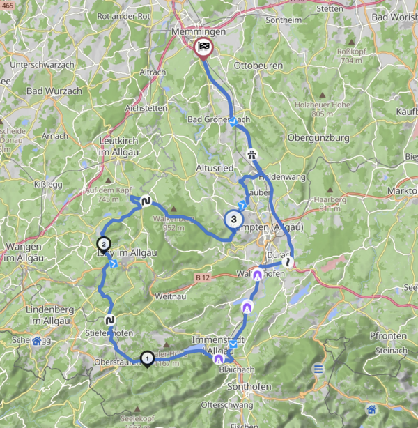
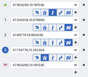
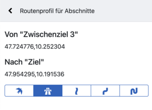
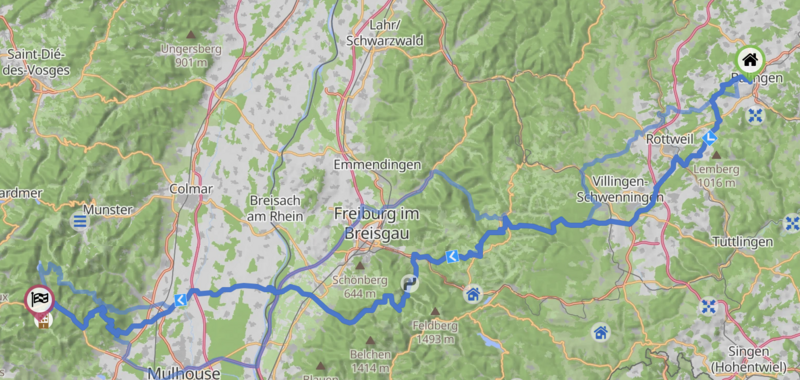
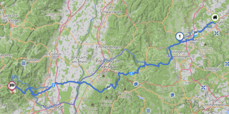
This feature allows you to plan tours that consist of several different route options. For example you can set the first part of the route to the fastest route, the second part could be extra curvy. You can use this feature in the sidebar and on the map.
You can also set parts of the route to use the straight line (beeline). This feature can be used to plan parts of the route as off-road or to ignore closures.
Change the Strength of Avoidances
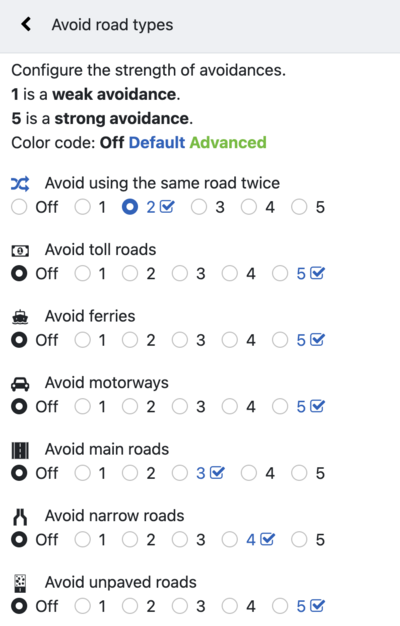
You can set the routing options to avoid certain road types or properties. These avoidances have a fixed strength. For example unpaved roads is a very strong avoidance and can create very long detours just to avoid a short stretch of this road type. As a Kurviger Tourer you have full control over the avoidances and can fine tune them to perfectly match your preferred way of riding.
You can change the avoidances on a scale from 1 to 5. 1 is a low avoidance. 5 is a strong avoidance. The default for every avoidance is marked with a check symbol.
Here are some examples where this might be relevant.
You might not like unpaved roads, but for a short stretch of unpaved road you are willing to avoid a long detour. As a Kurviger Tourer you can reduce the strength of the unpaved road avoidance from 5 to 1 or 2.
You might want to avoid all main roads and mostly ride on minor side roads. By default the main roads avoidance has a medium strength. Due to that, main roads are not avoided too strongly to create bigger detours. If you don't mind the detour, but want to enjoy the peace and quiet of a side road, turn up the avoidance to 5.
Show Road Closures, Unpaved Roads, Max Speed along your Route
We have all been there. You plan a nice route, it seems marvelous on the map. When you actually ride the route, you realize that a part of the route might not be accessible on weekends, or that a part of the route is unpaved. If you had known this before, you might have chosen a different road. As a Kurviger Tourer you can find out these details before actually riding the route. Please note: the data is based on OSM data, the data is not always perfect, so some information might be missing.
On the route you see symbols and marked parts of the route:
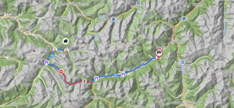
These parts are also marked in the elevation diagram:

You will also see an info icon in the info panel:

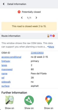
When you click on the symbol on the map, you see a lot of details from OSM. There are also links to cross check the data on Google Maps (and Streetview) and Mapillary:
In addition to the route information, you can also switch to the maximum speed:
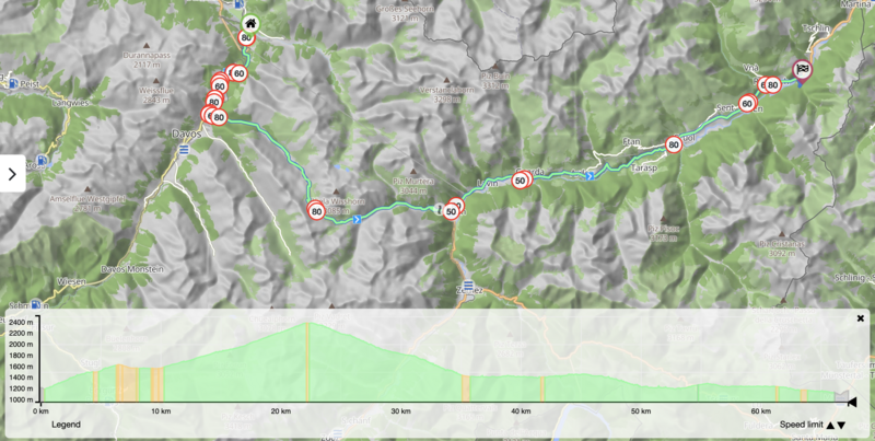
The feature only works, if you have the elevation diagram enabled (you can set this in the settings). You can switch between the route information and the max speed in the elevation diagramm in the bottom right, there are two arrows to switch between the shown information.
Advanced route transfer, including waypoint names and shaping points
Transfer planned routes to your navigation device. The limited route transfer allows exporting only without waypoint names and shaping points. With Kurviger Tourer it is possible to export the names of waypoints and shaping points.
Show all curvy route modes at once
A good tour is diverse. As a Kurviger Tourer you can see all three curvy route modes at once. There is one selected mode, for example Curvy, then Fast and Curvy and Extra Curvy would be shown as alternative route on the map.
In this example you like the Curvy route, but you might want to include one of extra detours of the Extra Curvy route, to improve the route. You can place a waypoint on the extra curvy part (right click on the map), the route will then usually follow the extra curvy part and you can continue tuning your route.
Roundtrips up to 600 km / 372 mi
For standard users, roundtrips are limited to 300 km / 186 mi. As a Kurviger Tourer you can plan tours up to 600 km / 372 mi.
Tourer+
Kurviger Tourer+ contains all the functions of Kurviger Tourer and additionally offers you the functions of motorbike navigation in the Kurviger Android App.
Navigation
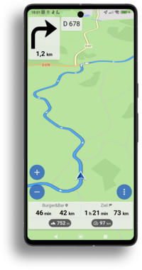
With Kurviger Tourer+ you can follow your planned route directly in the Kurviger app. The full navigation in the Kurviger app offers both voice-guided instructions with turn-by-turn directions and automatic recalculation as well as clear visual guidance to guide you safely along your planned routes. You can also keep track of important information, such as the distance to your destination or your stopover and much more.
Offline Maps
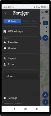
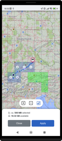
Tourer+ also includes offline maps. You can manage them easily in the Kurviger offline map manager. With offline maps you can navigate along your route even if you have bad reception. If you want to learn more about the offline map manager in the Kurviger app, we recommend you have a look at our content on this topic.
Further questions?
Do you have further questions about the premium options? Then you can also visit our YouTube channel. There you will find some helpful videos from the “Kurviger Explained” series. We recommend the Kurviger Explained video about the premium options.
You can also contact us at any time in the Kurviger Forum. There we will help you with your enquiry as quickly as possible.
